
Post Contents:
- Public Trans and Driving Directions
- Trail Map and Hike Directions
- Book Picks at Amazon: Books Blog, Category II.
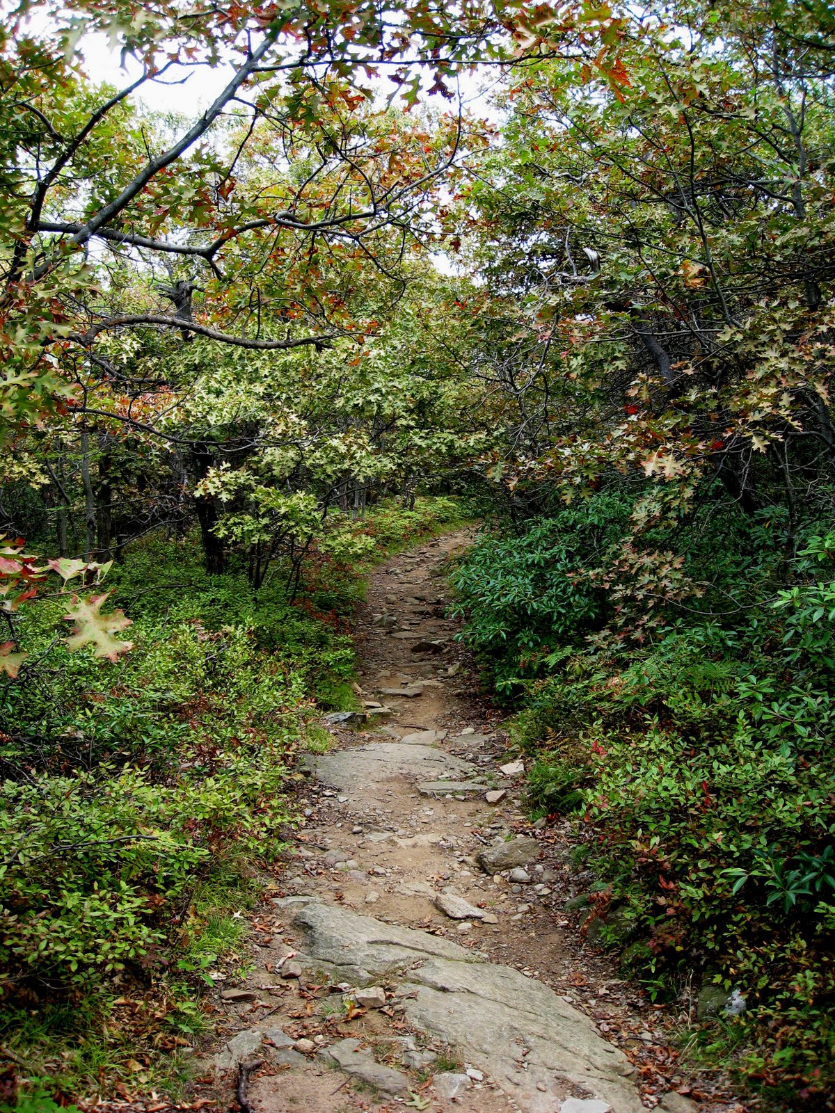
- Scenic Views, a Photo Preview
It was in the midst of this very scenery that we clocked about 6 miles on the old pedometers yesterday! Yeah, not that many miles, but what a full-body workout you get on that steady, at times steep ascent! You do the entire 1400 feet before lunch at the summit, and then it's all downhill from there.
Transportation: When we searched the AMC site for a hike near NYC reachable by public transportation for this weekend, we were happy to see that our favorite, fearless leader was making his September trek up to the summit of Bull Hill, aka Mount Taurus , in Cold Spring Harbor. We caught the 9:50 Metro North Hudson Line train from Grand Central Station to Cold Spring and met the group at 11:10 as scheduled.
Driving Directions:New York, NY (about 1 1/2 hrs.)1. Take George Washington Bridge Upper Level to New Jersey.Take exit 74 for Palisades Pkwy(Toll road) and merge onto Palisades Interstate Pkwy.Re-Entering New York: Exit onto US-6 E/Palisades Interstate Pkwy toward Palisades Pkwy/Bear Mountain/W Point. At the traffic circle, take the 2nd exit onto US-202 E/US-6 E (Partial toll road ). Turn left at New York 9D N/Bear Mountain-Beacon Hwy. Continue to follow New York 9D N passing through the town of Cold Spring, passing the intersection of NY9D and NY301, go about another half mile and park in lot on right at the Washburn Trail markers: white blazes.
Trail map of Cold Spring and Mount Taurus, (below).
Trail Map:

Hiking Trail Summary: The Washburn (white), the Notch (blue), the Brook (red), and the Cornish (blue) for the finish. See important detailed trail notes at end of this post.
Photo Preview:
The trail head is just 0.8 of a mile north of the railroad station on Route 9D; some walked, but we took a ride. At the parking area of Little Stony Point, turn right onto the White Trail. It's all uphill with better and better views to the south and west for about an hour and-a-half before reaching the tree-shaded summit.


Hiking poles really help you to keep your balance and to keep some of the weight off the knees.

A short stop along the way for a look back at Cold Spring and the Hudson. At this point, Fearless Leader (FL) sent ahead the part of the group that wanted to ascend at a faster pace with the instruction to wait up for the rest of us at the junction of the White and the Yellow Trails.

We gave a snake (probably a harmless milk snake) the right of way.


The last few feet felt the hottest.
 We chose a low rock in the shade, right smack in the middle of the White Trail. Of course we pulled our feet in to let people pass. Oops! One of us discovered he forgot to wear his regular trail boots...
 Can you beat this?
 The Catskill Mountains are in the far distance, and that's the Beacon Tower on the north ridge of Breakneck Mountain just across the valley. We saw two hawks zoom in together, and then soar apart, one to the south and the other to the north.
 Back on our feet and on the White Trail for the descent. We took it as far as the Blue, or Notch Trail.
 Three trail markers in a triangle on the tree with the single one above the other two indicate the beginning of a trail. Here we go south onto Blue.
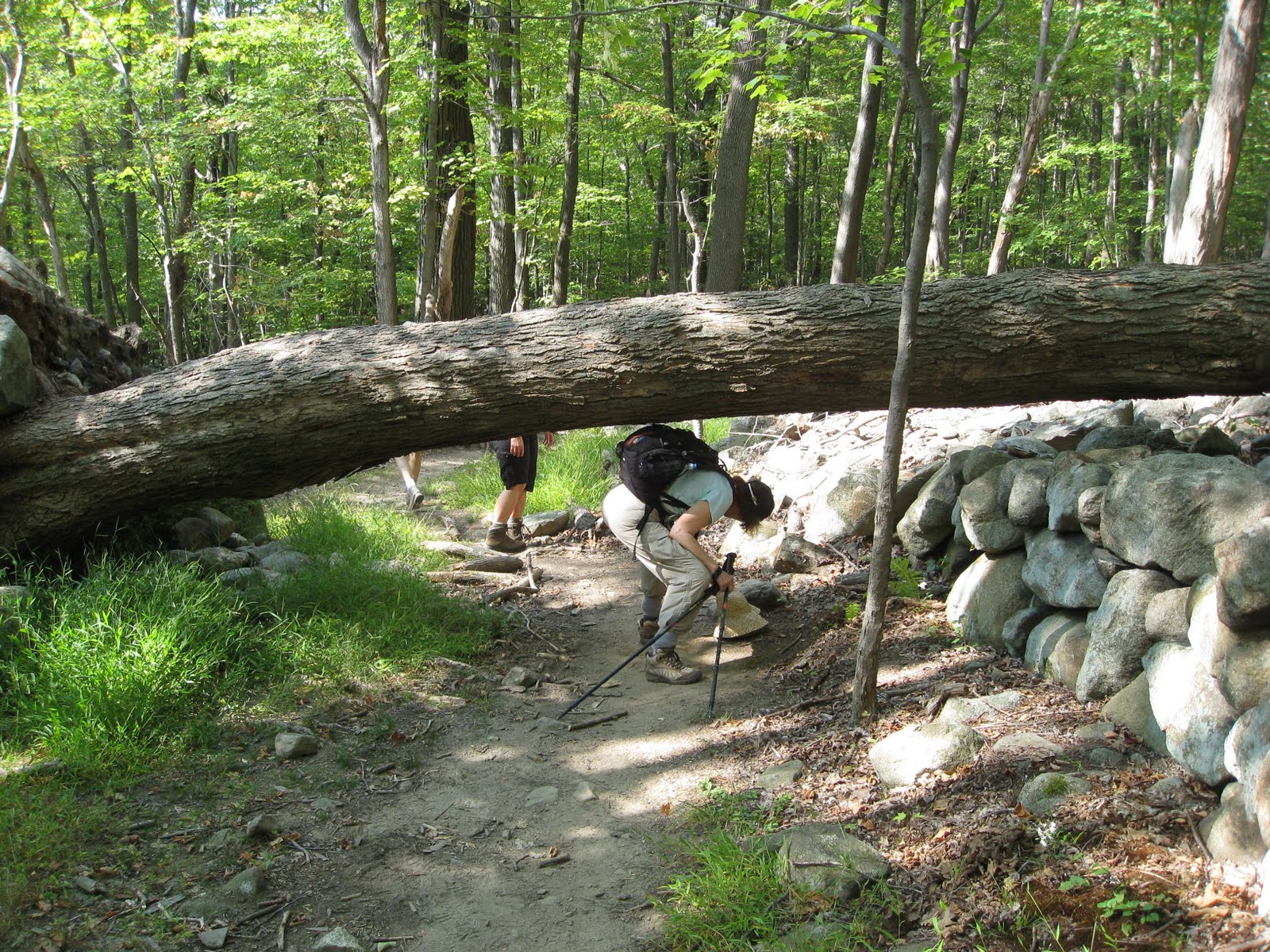
 There are lots of downed trees in these woods.
 We recognize some of the same ones year after year. The seeming stillness must be rattled often by turbulence.
 When it was time to walk the plank, a few of us preferred the lower path...
 Rock hopping across the brook was fun.

 This structure is one of several ruins from the Edward J. Cornish Estate of the National Lead Company. Cornish died in 1938 and the estate has been abandoned since then. The linked site gives the interesting history along with photos of the grounds.
 We turned south on the Red Trail...
 and passed the hearth...
 and more ruins of the Cornish Estate main house, and then, when Route 9D was in view, in order to avoid walking the last, short stretch out on the road, we turned left on the Blue Trail and were able to stay in the woods all the way back to the parking lot at Little Stony Point.
Important Detailed Trail Notes:
Total Distance: 5.2 miles
Ascent: 1400 ft.
1. Washburn trail (white blazes) to summit of Mt. Taurus, also marked Bull Hill.
2. Continue on the Washburn trail, past the yellow Undercliff trail to the intersection with the Notch trail (blue blazes). 3. Go, straight onto the the Notch trail, which is not always well marked. Avoid a right turn onto the green Lone Star trail).
4. Go left onto the Brook trail (red blazes) and pass the yellow Undercliff trail up to the Cornish trail (blue blazes).
5. Stay on the Cornish trail (blue blazes) when the Brook trail goes right. The Cornish trail is partially paved and leads almost to a gate at the road, but veers left and becomes unpaved back to the parking lot.